Print a copy for each student: Intro to Ground School: 5 Navigation
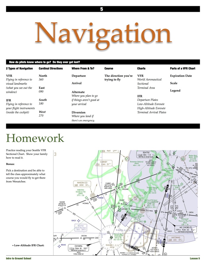
Unfold a copy of your local sectional chart and explain it to the students. Toward the end of class, show copies of low altitude and high altitude enroute charts, and a terminal area chart, for comparison.
At the end of the class period, distribute a copy of the sectional to each student for them to keep.